We're staying at the Medina/Lake Wildwood KOA, about 40 miles East of Niagara Falls.
We had originally planned to drive around the edge of Lake Ontario to get here but that would have involved driving on some Parkways. For whatever reasons (probably good ones like narrow roads and low bridges) RV's are not allowed on Parkways in New York. I think that Stacy and Jack ran into a similar law in Connecticut. Instead, we drove South to the New York State Throughway and then West.
It was a very tense trip. A couple of areas were under construction. The 2 lanes were barely enough for the trailer and the temporary concrete rails were right on the lines. I had no choice but to straddle the line between the lanes.
Then there were the people who don't know how to merge onto the highway. Until this trip, I thought that Tennessee drivers were the worst mergers. I think that upstate New York may have them beat. Towing a trailer, I'm usually doing about 60 and I stay in the slow lane. When I see oncoming traffic, I adjust to give them room. The throughway on ramps are very long. Cars should come on, get up to the speed limit and merge. These idiots, come on, get up to the speed limit, look in their mirrors for the first time, see me giving them plenty of room and hit the brakes. I'm left with the choice of running them off the end of the ramp or coming to a near standstill on the Throughway.
Enough of the bitching and moaning. This campsite is one of the nicer that we've stayed in and we practically have the place to ourselves. The RVs that are here seem to be packed away for the year. The few people that we've talked to seem to be sealing things up tight before the place closes on October 9.
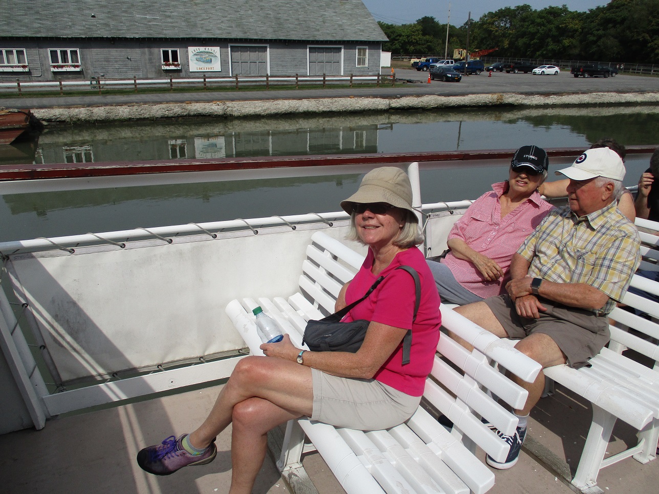
First Full Day: Lockport
Stacy and Jack talked in their blog about Lockport. It is the site of a staircase of the final five locks that take the Erie Canal up to the level of Lake Erie. The original 2 parallel sets of 5 locks (One set for Eastbound and one for Westbound) were rebuilt in the mid-1800's. Sometime in the 20th century, one of the sets was replaced with a much wider pair of locks that could climb the 50 feet in 2 steps rather than 5 and could handle Eastbound and Westbound traffic simultaneously.
 |
| One of the old canal boats in one of the now retired locks. |
 |
| We arrived just in time to a couple of Eastbound boats coming through the lower lock. The water is at its highest level here. |
 |
| With that boat still on the other side of these doors, the water started to churn as it was released downstream. |
 |
| Looking down on the lowered boats. The dark mark on the wall of the lock indicates where the water level was in the first photo. |
 |
| The nearly open lock doors.They can't start to open until the water level is the same on both sides. |
 |
| The boats can now proceed. |
We should have left well enough alone after we were fortunate enough to see the locks in action. But no, we decided to take a cruise through the locks. If it had just been through the locks, it would have been great. Instead, it was a 2 hour cruise and it was hot and humid down in the canal channel.
The cruise went an extra couple of miles West to see where they had had to carve the canal out of solid rock. On the return trip, it passed our starting point (Oh no! Let us off!) and went a couple of miles East to see where they'd used the solid rock cliff of the Niagara Escarpment as one bank and the soil and rock that they dug out to form the other bank. The town below that levee is called Lowtown.
The Eastern leg passed a couple of bridges that left me wondering. These feats of engineering had to be raised 15 feet every time a boat came through. It seemed like it might have been a lot cheaper and simpler to just build the bridges 15 feet higher. Of course, that would have left the 2 guys who push the buttons without jobs.
 |
| Our boat. |
 |
| Approaching the first lock. That's the old/narrow lock on the right. |
 |
| Entering the lock. Again, the dark walls indicate the upper water level. |
 |
| Water coming in - almost up to the line. |
Watching the gate open:
 |
| Closing behind us. |
Obviously, the second lock was pretty much the same.
A couple of things that I learned that I never really thought about before:
- The water level of the canals need to be kept constant. They have occasional weirs, particularly below each set of locks, to let excess water drop off into side streams.
- The locks and some canal sections are empty between November and March/April each year. They don't want the freeze/thaw to do damage.
Second Full Day: Fort Niagara and Niagara on the Lake
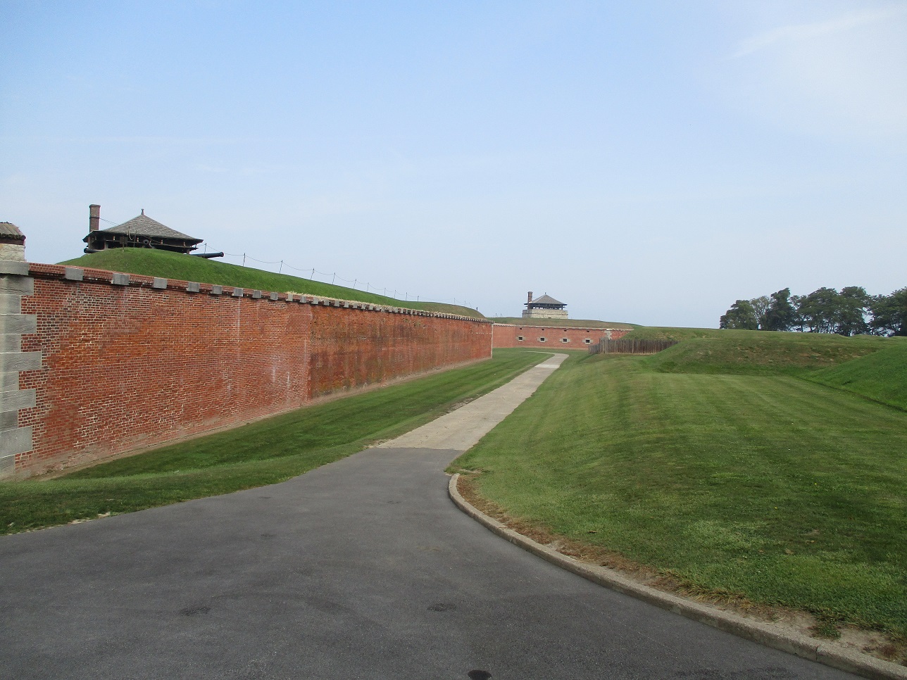
Fort Niagara was very interesting. It was originally established by La Salle during his explorations of the Great Lakes. The French built it up because of its key position for controlling the Great Lakes and the fur trade. The Fort played an active part in the French and Indian War, the Revolution and the War of 1812. As near as I could determine, it just about always ended up in the possession of the losing side and was then reassigned under the treaty terms.
It was interesting that the original French structure was a beautiful chateau. The British added a number of other stone structures. The Americans added a log cabin.
 |
| The entrance. |
 |
| Looking along the wall. |
 |
| The gate. |
 |
| The original fort was this structure only. The French didn't want to offend the Iroquois by making it look too much like a fort. Originally, the gun ports faced Lake Ontario. During the War of 1812, the British were able to bombard the fort from the higher, Fort George on the opposite bank of the Niagara. The Americans removed and turned the roof, giving them the height advantage and blew Fort George to smithereens. |
 |
| Inside the chateau: The trading room |
 |
| Inside the chateau: Enlisted men's barracks. |
 |
| Inside the chateau: Officers dining room |
 |
| Inside the chateau: Another enlisted men's barracks (this one done up). |
 |
| Inside te chateau: Upstairs in the gun room. |
 |
| Inside the chateau: The view from the gun room. |
 |
| The bread baking kitchen. |
 |
| Looking across at Fort George. |
 |
| Log cabin in the middle. Close up is the forge that was used for heating canon balls. In the distant is one of the t redoubts that were added later to prevent attackers from approaching by land. During the French and Indian War, the British were able to cut zig-zag trenches and get close enough to attach the chateau with canons. |
 |
| Another shot of the chateau. |
 |
| The powder magazine, with its 4 foot thick walls, was added later. |
 |
| The outside of the powder magazine. |
 |
| Atop one of the redoubts. |
 |
| View from the redoubt. |
 |
| The quarters on a lower level of the redoubt. |
And then we crossed over into Canada to have lunch in Niagara on the Lake which, curiously is the site of Fort George (which looks like a nice park now).
 |
| It's Canada's 250th anniversary (of what, I'm not sure) and beautiful flower displays are everywhere. |
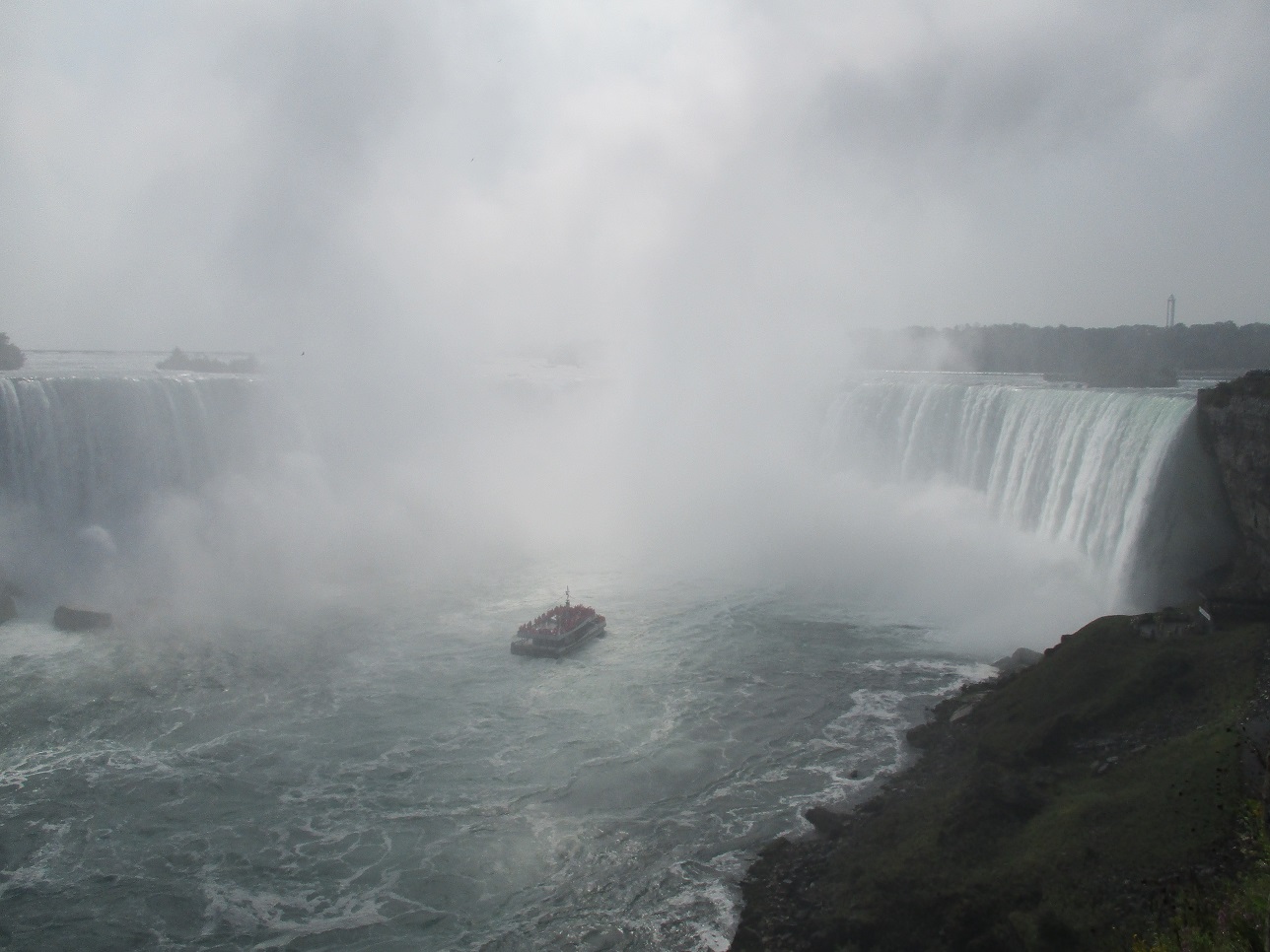
Third Full Day: Niagara Falls , Canadian side
We've been to Niagara Falls twice before. The first time was a day trip to the Canadian side when we were staying in Toronto. The second time was during our move East in 2015 (we visited the US side). It was the Canada side's turn again so that's where we ended up.
 |
| From under the Rainbow Bridge, that's where we caught the Maid of the Mist last time. |
 |
| American Falls. |
 |
| Horseshoe. |
 |
| More of those flowers. |
 |
| Horseshoe. |
 |
| Near the edge of Horseshoe Falls. |
 |
| Looking over the edge of Horseshoe Falls. |
We had a great lunch at a restaurant called Queen Victoria Place. The views were incredible.
-JC-


No comments:
Post a Comment